Author: Peaks and People

  • The Sandžak #2: the road to Sjenica is covered with rocks

    The Sandžak #2: the road to Sjenica is covered with rocks

    What happens when you ask a local in Prijepolje what’s interesting in his town? You’ll end up driving around in his car for an hour and a half, seeing not only the town, but also a canyon/film set and a medieval monastery, after which he pays for your lunch. I won’t say this necessarily will happen to you, but it happened to me during my first day in the Sandžak. Off to a good start…

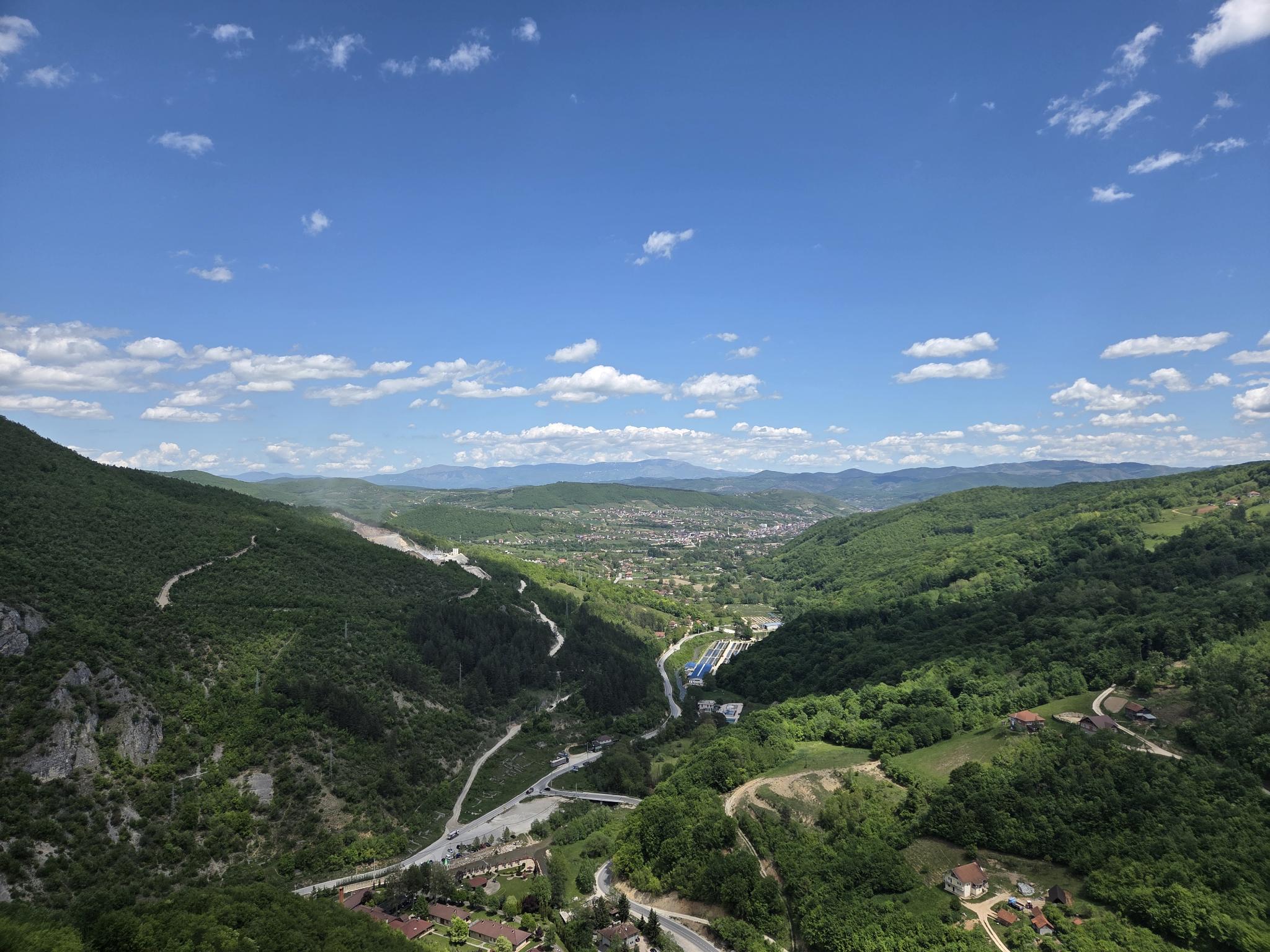
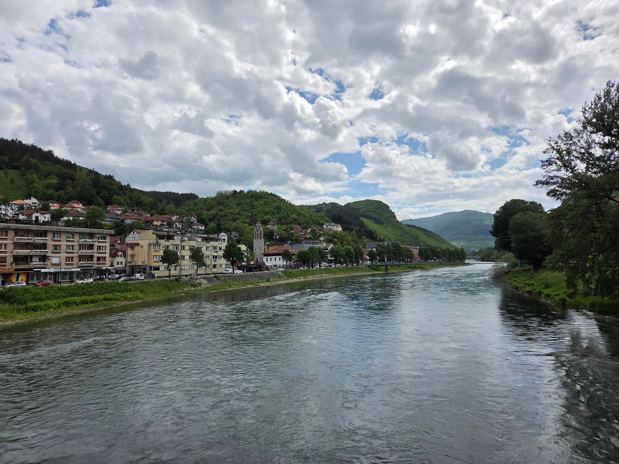
    After a good night of sleep, I wake up in Prijepolje. The previous evening I arrived in this small town from Sarajevo, after a 3,5-hour drive in a small van . Prijepolje is located in the northern part of the Serbian Sandžak, close to the Montenegrin and Bosnian border (you can see my route through the region here). Its 30 000 inhabitants can enjoy the beautiful hilly surroundings as well as the confluence of the wild Lim and Mileševka rivers. I myself, an ignorant tourist, decide to ask the friendly owner of my apartment if he can give me some recommendations in Prijepolje. We end up talking and before I know it we jump in his car for a ‘quick’ tour around Prijepolje.

    The confluence of the Lim and Mileševka rivers in Prijepolje
    The confluence of the Lim and Mileševka

    A monastery, a canyon and a film set

    While driving, we talk about life, religion and Prijepolje. The owner (I prefer not to share his name here) talks about Prijepolje in the nineties. Back then there were around 50 000 inhabitants, but a lot of them emigrated, because of ethnic tensions and later on because of the bad economy. The Serbians, he says, had the feeling that everything belonged to them and so in Bosnia they did things like Srebrenica and other cruelties. He’s talking about the genocide in Srebrenica in 1995, where 8000 Bosniak men were killed by Bosnian Serb soldiers, an event that the Serbians until today don’t recognize as a genocide. He himself is a Bosniak and speaks passionately about his beliefs. The Christians, he tells me, say that Jesus is the son of God. But Jesus had a nationality, an ethnicity, so how can he be the son of God, if God is universal? It’s an interesting thought on which I can’t reply much, since my Bosnian vocabulary contains only a limited number of theological terms. Still, he has no problem at all showing me the monastery of Mileševa.

    The monastery is located to the southeast of Prijepolje, along the Mileševka and dates from the 13the century. It features a church of which the lower parts are decorated with beautiful frescoes. The most famous one being the fresco from the White Angel (Beli Anđeo), showing an angel sitting on the tomb of Christ (unfortunately, taking pictures wasn’t allowed, so you’ll have to Google it). Beside the church there is a kind of guest house where pilgrims can stay, a shop, a picnic place at the bank of the river and of course a parking for all the buses with visitors. The monastery is quite popular, also because the relics of Saint Sava, probably the most important Serbian saint, were kept here up until the end of the 16th century. No wonder everything is well-maintained and in a very good shape.

    The monastery of Mileševa
    The monastery of Mileševa

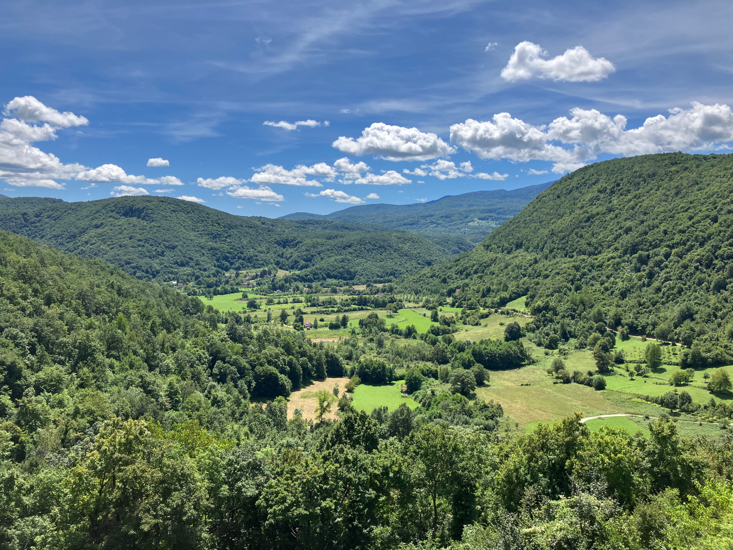
    We continue our trip and soon arrive in the canyon of the Mileševka, a beautiful canyon, where you can hear but not see (too much trees and bushes) the river flowing. The asphalt road changes into a gravel path and eventually we continue on foot, since there are too many rocks. The owner explains to me that in Yugoslavian times, they wanted to construct a road here that connects Prijepolje with Sjenica, a town 30 km to the southeast of Prijepolje. But, in Sjenica the population is almost exclusively Bosniak, while in Prijepolje only 40% of the people are Bosniaks. So the Serbians, wanting to avoid too much connection between the Muslims, obstructed the construction and the road was never finished. I’ couldn’t entirely confirm this story, but it’s a fact that along this path we find multiple tunnels that were clearly built for cars and not for hikers and squirrels. In one of these tunnels the famous Serbian movie Lepa sela lepo gore (Pretty Village, Pretty Flame, 1996) was filmed. It tells the story of a group of Bosnian Serb soldiers during the Bosnian War, trapped in a tunnel by Bosniaks. A popular, but not uncontroversial movie.

    Unfinished tunnel along the canyon of the Mileševka
    Would you dare to enter?

    A mosque with a robot vacuum cleaner

    We turn back to the city center and I ask him if he thinks that the road will ever be finished. He says it’s possible, but it depends from politics. Without Kosovo, he says, there are around 6 million people in Serbia, of which 2 million live in the capital. So where does all the money go? To the capital. And in Serbia, we have a lot of corruption: if you’re a member of the ruling party [the SNS, Srpska Napredna Stranka], everything is possible: even a baker or a taxi driver can become a minister, even if you’re incompetent. If I look around me, I can’t argue with him: the infrastructure is bad and looks old, certainly compared with Belgrade, where there are a lot of fancy building projects.

    We arrive at the mosque, where the owner usually prays. It’s a small and simple mosque with some Ottoman tombstones in the yard. The inside is simple and of course without frescoes, but it does feature a robot vacuum cleaner, making sure the carpet stays clean all the time. I laugh at the sight: who says the Islam can’t be modern? We drive through the city center, past the market and the big mosque and a pattern becomes clear to me: the only buildings that are consequently in a good shape, are religious buildings. Private houses are often not entirely finished, with exposed brick walls, while government buildings look old and almost derelict. Maybe this says something about who has money in Serbia?

    An unexpected encounter …

    Our tour is almost finished but before we end I ask the owner if he wants the Sandžak to join Bosnia. He nods negatively: “there is no need to, nowadays we can do everything we want: speak Bosnian, go the mosque … The relations between Serbians and Bosniaks are okay, there are some tensions, but we can live peacefully.” Still, three of his children study in Sarajevo, rather than in Belgrade. Why? Because its’ a better environment, he says. Our tour ends and he stops close to a bakery where he orders a komplet with ćevapi for me: it consists of lepinja (flat bread) with scrambled eggs, kajmak (a kind of cheese) and ćevapi, the small sausages that are the pride of approximately everyone in the Balkan. I protest, but can’t avoid that he pays my lunch, after which he leaves me and goes back to work. Hospitality at its peak.

    A Yugoslavian Dom Kulture and a shaky bridge

    After lunch I wander around in Prijepolje and end up in the Dom Kulture, or Culture House. The name says it all: a theater/library/music school that was built in 1979 (back then called the House of Revolution). From the outside it looks run-down, but the inside is actually pretty nice (some financial support from Turkey may have helped with that). Two friendly ladies show me around. It has a great hall that can accommodate over a thousand visitors (a little much maybe, but remember, this was a way bigger town back then), and a small hall with 200 seats. Furthermore there is a library, music school and two galleries. One with quite modern local art and one that is currently closed but is dedicated to the local history. All in all, a pleasant surprise and my first Yugoslavian Dom Kulture.

    I continue my walk and pass by the big Mahmut-Begova mosque and the Orthodox church, both nicely decorated, the first one with geometric patterns and a dark wooden interior, the second one with colourful frescoes. I decide to go to the other bank of the Lim, crossing the most shaky and rusty pedestrian bridge I have ever seen. The other bank is mainly a residential area, but it’s also where the railway station is located. As a train enthusiast I was eager to see it, but it turned out to be a bit of a disappointment: the station was in a bad shape, featuring tracks covered with weeds, an old railway building and a passenger tunnel with such an intense urine smell that I didn’t dare to enter it. My assumption about the infrastructure was once again confirmed. Still, a few trains a day stop at the station, being located on the line between Belgrade and Bar in Montenegro.

    The fortress of Mileševac

    Having some energy left, I decide to take a taxi to the fortress of Mileševac. A fortress that was built in the 14th century and is located on top of a cliff at the other side of the canyon from the Mileševka. I saw it on my trip to the tunnels in the morning and was intrigued by it. It’s located in a small village, Hisardžik, and was actually part of a medieval town (also called Mileševac), with the fortress located on top of the cliff and the lower town being where today Hisardžik is located. In the village there is a small mosque with a beautiful 400-years old handwritten Quran. But the mosque was closed, so no pictures here. I walk up the cliff along a path that changes between being clearly visible and non-existent. After a short but exhausting hike I arrive at the fortress: the views are stunning, but the fortress itself isn’t quite accessible and seems to consist mainly of crumbling walls (in contrary to what the information panel says). It has great tourist potential, but unfortunately, it doesn’t seem to get much care.

    When I’m walking back from the fortress I once again pass by the monastery of Mileševa. There I observe a scene that seems to be illustrative for the infrastructure in the Sandžak: an old Lada with three police officers cramped inside passes by. A minute later, an Orthodox priest leaves in his brand new Škoda-SUV.

    Leaving Prijepolje

    Before ending this long post, I only want to describe two more things. The next day, when I was preparing to leave for Novi Pazar, I passed by the Orthodox church where there was quite a crowd. A lot of policemen were watching and even the fire brigade and an ambulance were present. What was happening? It was the slava of the church. This is the annual celebration and veneration of the patron saint of a family, monastery or church. A very important event for Serbians, for which – in this case – a procession was held. The procession featured a lot of Serbian flags (with or without coat of arms), including one of the longest flags I’ve ever seen, people in traditional clothing, a pick-up truck with a giant icon, a lot of clergy and lay people holding small icons. Quite impressive, if it where not for all the umbrellas (it was raining heavily) that made it all a little less … solemn?

    Have you ever seen such a big icon?

    While waiting for this procession to leave, I decide to quickly take a look at the small Roman-Catholic church, that was located at the other bank of the Lim. It was built during the Austrian-Hungarian time near the barracks of the (Catholic) soldiers. The information panel states that it “enjoys the protection and affection of all citizens of Prijepolje.” I’m willing to believe that, but it certainly does not get much protection and affection from the government …

    The Roman-Catholic church of Prijepolje
    A well-preserved Roman-Catholic church

    My journey through the Sandžak:

  • The Sandžak #1: an introduction

    The Sandžak #1: an introduction

    Welcome on the first ‘People’ series of my blog! In this series I will take you on a journey through the Sandžak of Novi Pažar, the little-known border region between Serbia and Montenegro. But don’t worry, it won’t be a boring history lesson, rather an array of impressions of this beautiful region with its shitty infrastructure and friendly people. Before we embark on this adventure though, let’s start with a little introduction.

    When I told friends, family or colleagues that I was going to travel to the Sandžak of Novi Pazar, the reactions can be summarized as “What?” and “Where is that?” So I got the impression that the Sandžak of Novi Pazar, or short: the Sandžak, isn’t a particulary well-known region in the world, unless maybe you live there or have a special interest in Southeastern Europe. Assuming most of my readers are neither, I think it would be quite fitting to give some background information about this region and what makes it different than the rest of Serbia and Montenegro.

    How it came to be …

    In the 19th century the two countries to which the Sandžak nowadays belongs became independent from the (less and less) mighty Ottoman Empire. Serbia gained independence in 1815 and Montenegro in 1878. These two countries are actually quite similar: they share the same religion (Orthodox Christianity) and are both South Slavic states speaking (more or less) the same language. So you can imagine that the (also less and less) dominant Central European power, Austria-Hungary, wasn’t keen on this two countries merging into one big South Slavic state, supported by Russia. That would be a rather big threat to their southern border. Thus, also in 1878, when after one of many wars between the Ottoman and Russian empire the map of the Balkan was redrawn, Austria-Hungary took its chance and military occupied the Sandžak of Novi Pazar, in this way creating a buffer zone between Serbia and Montenegro.

    But, what was this Sandžak? Well actually, the Sandžak as such never really existed. The word is derived from the Ottoman Turkish word sancak, meaning flag or banner, and was used to indicate an administrative division within the Ottoman empire. Thus in the 19th century there were around 150 of these sancaks (or districts), of which one was located around the city of Novi Pazar, a city in what is today southeastern Serbia, close to the border with Kosovo and only forty-something kilometers from Montenegro. The sancak of Novi Pazar was only created after an administrative reorganization in 1864, but still came to be the only sancak of which we speak today, but then in the Serbo-Croatian form of the word: the Sandžak.

    The occupation of the region by Austria-Hungary had an unforeseen side-effect: the Muslim population in the Sandžak largely continued to live there, since the Austrian-Hungarians wanted to protect them as a counterweight against Orthodox influence. This wasn’t the case in the independent states of Serbia and Montenegro, where, as you can imagine, they weren’t big supporters of the religion of their former (in their words) suppressor. Austria-Hungary ended its occupation in 1908, but the Ottoman Empire could enjoy its regained rule only for a few more years, since after the Balkan Wars in 1912-1913 the Sandžak was lost definitively and was divided between Serbia and Montenegro. Still, the following decades, the Muslims could largely maintain their presence in the region, thus creating the main characteristic of the Sandžak: it is populated mainly by Muslims, in contrast to the other parts of Serbia and Montenegro.

    Graffiti in Suvi Do saying "This is Turkey"
    “This is Turkey”-graffiti in rural Sandžak. Would the stork agree?

    Becoming Bosniak

    Fast forward to the eighties and nineties: the communist state of Yugoslavia (which also had Serbia and Montenegro within its borders) is falling apart after the death of its leader Josip Broz Tito, the glue that held together the different nationalities of this multi-ethnic state. Nationalism is on the rise and erupts particularly violent in Bosnia and Herzegovina, where the Catholic Croats, Islamic Bosniaks and Orthodox Serbians start fighting each other. If you ask me, they aren’t that different: they speak variants of the same language (Serbo-Croatian or Bosnian/Croatian/Serbian/Montenegrin (BCSM) as it is called today), eat the same things and listen to the same type of music. But remember: these were very nationalistic times and hatred was omnipresent.

    These events also had an effect on the Sandžak. Based on religious and historical reasons, the Muslims start to identify more and more as Bosniaks (who speak Bosnian), thus expressing a certain connection with the Bosniaks in Bosnia and Herzegovina. This also leads to a wish for political autonomy or even unification with Bosnia and Herzegovina. Political parties were formed, tensions between Serbians and Bosniaks grew and even a referendum was held but eventually nothing really came from it. Why? Because the Sandžak simply didn’t hold the right cards: it was an economically weak region, with a divided population (even within the Bosniak majority) and without forming one administrative unit (in contrast to Kosovo for example). Unification with the Bosniaks in Bosnia and Herzegovina furthermore seemed impossible since most Bosniaks in the region didn’t even live close to the border with Bosnia. So by the end of the nineties the different political parties that where striving to (different forms of) autonomy of the Sandžak were incorporated in the Serbian political system. Illustrative for the division is that on the Montenegrin side, there never really were Bosniak parties seeking autonomy. Eventually the region became divided again in 2006 after the independence of Montenegro from Serbia.

    Mural in Novi Pazar sazing "Bosnian, because we are Bosniaks"
    “Bosnian [language], because we are Bosniaks” – emphasizing identity in Novi Pazar

    The situation today

    The next posts will of course give you a more detailed insight in the actual situation of the Sandžak, so let me just focus on the key points here.

    The Sandžak today is a region of around 9000 km² in southwestern Serbia and northeastern Montenegro, consisting of six Serbian and eight Montenegrin municipalities (although Andrijevica, Plav and Gusinje in Montenegro aren’t always seen as part of the region). The biggest city is Novi Pazar, which is – with around 70 000 inhabitants – the informal capital of the region. The region has approximately 350 000 inhabitants of which around 55% are Bosniaks, but mind you: not every Muslim is a Bosniak, there are also Albanian Muslims and Muslims who speak BCSM but don’t identify as Bosniak (but I won’t dive too deep in this here). The Bosniaks mainly live in the parts of the Sandžak bordering Albania and Kosovo, while Serbians and Montenegrins make up (most of) the remainder of the population.

    Politically there exist several parties who represent the Sandžak and the Bosniaks. In Serbia we have for example the Stranka Demokratske Akcije Sandžaka (the Party of Democratic Action of Sandžak) and the Stranka Pravde i Pomirenja (the Justice and Reconciliation Party) and in Montenegro the Bošnjačka Stranka (Bosniak Party). Furthermore in both countries exist councils (a kind of representative bodies) that try to protect the cultural, linguistic and religious identity of the Bosniaks. But, like I said, all within the current borders: the wish for independence or unification with Bosnia seems to have faded away. Nowadays they rather call for some rather sort of self-governance or want to create a cross-border ‘Euroregion’, with close cooperation between the different parts of the Sandžak. Most striking to me though, was the sheer amount of offices these (and other) parties had, even in the smallest towns.

    Last but not least, let’s talk economics: it’s bad. There is some industry: coal mines, a (military) truck manufacturer and a lot of textile industry (in Novi Pazar), but a lot of the factories I saw, seem to have been closed down after the breakup of Yugoslavia. Meanwhile you’ll regularly bump into a herd of sheeps or goats when driving around and it won’t be any problem to find onions, potatoes or homemade honey by the side of the road. These roads can be good, but also quite ‘patchworky’ and will never be highways. Furthermore, there are no international airports and only one (scenic) railway line runs from north to south through the region (as part of the Belgrade-Bar railway) . Poverty levels are high, as are unemployment levels (in some places around 60%). No wonder a lot of people (regardless of their ethnicity or religion) decide to emigrate to Western European countries as Germany or Sweden.

    Sounds interesting to you? Join me now on my journey through the beautiful Sandžak!


    Some sources

  • Climbing Bosnia’s highest mountain: the Maglić (2386m)

    Climbing Bosnia’s highest mountain: the Maglić (2386m)

    In this post I would like to tell you the story about how I climbed the Maglić, with its 2386 meters the highest mountain of Bosnia and Herzegovina. This is the first episode of my series ‘Balkan’s highest peaks’ in which I try to climb the highest mountain of every Balkan country.  I took this adventure on me in the summer of 2024, when I was following a summer course of Bosnian/Croatian/Serbian in Sarajevo, the capital of Bosnia and Herzegovina, which means that I’m writing this from memory, so please, don’t shoot me if I get some details wrong.

    Getting to it

    My adventure starts on a Friday evening. After my daily course, I hurry myself to the rental agency, where I had reserved a car a few days earlier. After some administrative formalities, it becomes clear that the car I had reserved, isn’t available. But, they assure me not to worry: a guy from another rental agency will come with a car and help me out. Turns out that this other car is a seven-seater Volkswagen minivan. Since I’m only one guy, my 20 liter backpack will enjoy the abundance of space and leg room on the rear seat. I start talking with the new rental guy in Bosnian, but when it comes to the technical explanation about which lights on the dashboard I can ignore, we switch to English. Still, when I’m saying my phone number in Bosnian, he calls me a mali bosanac or a ‘little Bosnian’. Can’t say I’m not flattered by this compliment.

    With all the practicalities behind me I can really start my endeavour. First I have to leave Sarajevo, which means entering Istočno Sarajevo (or ‘East Sarajevo’), a new city created after the war mainly populated by Serbians and belonging to the Serbian part of Bosnia (the Republika Srpska). This ‘border-crossing’ is noticeable: no more remembering Srebrenica here, but a sign about the 157 000 Serbians that had to leave Sarajevo at the end of the war and flags of Serbia and the Republika (which is very similar to the Russian flag) everywhere. Luckily, the scenery doesn’t care about ethnic divisions: driving in Bosnia is like driving in a postcard, or rather, driving in a lot of different postcards, since after every corner there is another beautiful view. I’m driving on the M18, a two-lane road which runs along rivers like the Željeznica, the Bistrica and more famously the Drina. This means: passing through gorgeous gorges and valleys surrounded by forests and rocky hills. I’m enjoying the ride but my radio connection not so much: the Balkan music that seems to play on every radio channel comes with a lot of distortion.

    When entering the Republika Srpska, the narrative immediately changes

    A small history of Bosnia and Herzegovina

    Writing a history of Bosnia and Herzegovina is a difficult and sensitive task. Since this post is primarily about nature, I won’t explain it all in full detail but rather give a brief abstract that hopefully makes you understand the sensitivities in this country.

    Where to start? After World War II the former Kingdom of Yugoslavia became a communist state under the leadership of Josip Broz Tito. It was a multi-ethnic state consisting of 6 republics (Slovenia, Croatia, Bosnia and Herzegovina, Serbia, Montenegro and Macedonia) that was mainly held together by the rule of Tito: ethnic differences weren’t invisible, but were more of a folkloristic thing. This changed after the death of Tito in 1980. The glue that held the state together disappeared and nationalistic tendencies started to spread. At the beginning of the 90’s the different republics of Yugoslavia started to declare their independence. For ethnic quite homogeneous republics like Slovenia, this was a rather straightforward process, but in Bosnia and Herzegovina things where a little different …

    Here we had the co-existence of three ethnicities. The catholic Croats, muslim Bosniaks and orthodox Serbians. The Bosniaks and Croats preferred independence, while the Serbians in Bosnia wanted to stay united with Serbia in Yugoslavia. Fighting between the three parties broke out in 1992 and went on for 3 years (in different constellations of who was fighting against who). It has to be said that war crimes were committed on all three sides and ethnic cleansing was a recurrent phenomenon. The most known example of this is probably the genocide in Srebrenica, when 8000 Bosniak men were killed by Bosnian Serbian troops (as you can imagine the Serbian view on this is a bit different). The war ended with the Dayton-agreement, which de facto resulted in an consolidation of the ethnic divisions. Bosnia and Herzegovina was divided in two parts: the Serbian Republika Srpska and the Bosniak-Croat Federacija Bosne I Hercegovine.

    Until today these three communities are living more next to each other rather than with each other and the political divide as well as the way they remember the war is totally different. An example is the siege of Sarajevo: during the war the Serbians besieged Sarajevo for almost four years. This is commemorated quite extensively in the now predominantly Bosniak city, while the narrative in the Serbian part is less about the siege and more about the Serbians who fled the city at the end of the war, when Sarajevo became part of the Bosniak-Croat Federacija (thus the sign when entering Istočno Sarajevo).

    Are we in Bosnia …. or in Serbia?

    It’s already dark when I arrive on my campsite in the small village of Popov Most, close to the Montenegrin border and to the National Park of Sutjeska, the oldest national park of the country, in which we also find the Maglić. Because of the yearly OK Fest (a three-day festival) that takes place there in July, it was quite busy and I was lucky to find a place for the night: a tent in the garden of a guest house. When I arrive, some Serbian festival-goers are sitting outside the house. I start talking in Serbian and ask them if they know where I can find my tent. Rather than answering they start asking me questions. They are quite intrigued by this strange Western European guy speaking Serbian and they invite me to sit with them. A gin tonic is pushed in my hands and a vivid conversation starts.

    Not long in the conversation I notice something odd: we are in Bosnia, more than a 100-km ride away from Serbia, but still for them, it is like they are still in Serbia. Everything they ask me is about Serbia: ‘How do you like Serbia?’, ‘What do you think of the Serbians?’, ‘Is it your first time in Serbia?’. It’s not that they are confused or anything, it’s just that for them Bosnia doesn’t really exist, it’s a part of Serbia. Since I don’t want to start any political discussions I play along and just share my thoughts about Bosnia, but I replace Bosnia by Serbia in all my sentences. Eventually the cognitive dissonance does become clear. When I tell them I drove here from Sarajevo and not from Belgrade, one person asks me: ‘So have you ever been in Serbia?’ A strange question to ask for a person who is convinced that we are in fact at the very moment in Serbia. It shows an interesting contradiction: of course they know that Bosnia is another country, but it seems like something they’d rather not accept. For me, it’s a bizarre but very interesting conversation. When I tell this story to my teacher back in (non-Serbian) Sarajevo, she sadly nods: it’s clear that the denial of Bosnia’s existence is not an exceptional thing.

    Ascending

    The next day I leave early to climb the Maglić. The ascend starts from a place called Prijevor (at a height of 1670 m), where there is not much more than a parking lot. To get there you have to follow an unpaved road for approximately 17 kilometers. The first part of the road is quite okay: a mix between a gravel road and remnants of a concrete road. It’s only after you enter the national park (which costs 10KM (Konvertibilna Marka, the Bosnian currency) or 5 euro), that the quality of the road deteriorates and big rocks and potholes begin to appear. I did all this in my minivan but not without a lot of sweating, so I would certainly recommend a 4×4, especially if you have a rental car. A 4×4 will also help to enjoy your surroundings during the ride, since the road goes through the primeval forest of Perućica, one of the last of its kind in Europe. After an hour or so I arrive at Prijevor. It’s around 9 o’clock and a few cars are already parked there. It’s sunny, but you can see the clouds in the valley, which makes me feel for a moment like the painting of Der Wanderer über dem Nebelmeer (‘the Wanderer above the Sea of Fog’) from Caspar David Friedrich (although the mood is a bit more positive).

    Cloudy in the valley, sunny on the mountain

    To climb the Maglić you can chose between 3 main routes. The first and most popular one starts from Prijevor and is a short but steep hike of 2 km on the northwest side with a via ferrata for safety. The second route is the least popular and starts from Lokva Dernečište (to the northeast of Prijevor). It’s a longer (and thus less steep) trail of around 4,5 km. The third route start from Montenegro and is a lot longer: around 9 km. It starts on the edge of the village of Mratinje and approaches the Maglić from the southeast (you can also start this route from Trnovačko Lake, which is a 1,5 hour hike from Prijevor). See the end of this post for more information about the routes. I chose for the second route, since I didn’t have a climbing helmet with me (which I would recommend for the first route) and was on the wrong side of the mountain for the third route.

    For this route you have to walk back a bit on the road to Prijevor, up until a junction where you turn right. Then, after 1,5 km you will see a trail at your right side which is the start of the ascent (you could park there too, although there isn’t a real parking spot). This route is also called the Postanski Put or ‘Postman’s Trail’ (the origin of the name is not clear to me, maybe it has something to do with its use by the partisans to avoid the Nazi’s during World War Two). From here it really becomes clear that the Maglić is in fact quite an impressive mountain.

    The northeast side of the Maglić

    The path begins in the forests, but it doesn’t take long before the trees are replaced by thorny bushes (a kind of maquis you could say). I encounter no other hikers and have to find myself a way through overhanging branches, which leaves me with the impression that this trail isn’t used a lot. Soon enough the bushes are replaced by rocks and scree and the trail becomes steeper. Meanwhile the sun is burning on my shirt, but the views make up for it: I can see far into Montenegro.

    View on Montenegro whilst climbing the Maglić

    The trail isn’t that technical (although physically demanding) and only occasionally I need to scramble a bit. Before I know it I reach the ridge that leads up to the summit. The Maglić actually has two summits: the Bosnian one (2386 m) and the Montenegrin one, which is 3 meters higher and thus called the Veliki Maglić (or ‘Big Maglić’). It comes as no surprise that the lower summit is climbed more, since it’s the highest mountain of Bosnia and Herzegovina. Once you reach the ridge it’s a short hike to the summit, only interrupted by a small scrambling section which should pose no big problems. And so, exactly at 12 o’clock I can say that I’ve climbed the highest mountain of Bosnia and Herzegovina. I take some pictures of the stunning surroundings and eat something. But even here, politics aren’t far away: on the summit stands a flag of the Republika Srpska. Some other (Bosnian) climbers don’t seem to like that, so they brought their own Bosnian flag and take a selfie with this one.

    The summit of the Maglić includes a well-decorated flag

    Descending

    For the descend, I walk back on the ridge, which means passing by the Veliki Maglić (if you would like to climb this peak too, it’s only a small detour). After 3 km the real descend starts in the direction of the beautiful heart-shaped Trnovačko Lake. As often, the descend seems more dangerous than the ascend: there is a lot of scree on the trail and I have to be careful not to slip. Descending also means crossing into Montenegro (although technically during the ascend the trail also went across the border for a small time) and thus entering another park, the Piva Nature Park. It’s not something you notice when hiking, but you have to pay a new entrance fee from 1 euro. I paid this fee when reaching the Trnovačko lake, after leaving the scree and entering the forest that leads to this mountain lake. Some advice: if you just avoid the mountain hut next to the lake, you’ll probably also avoid paying this fee. From the lake it’s an 1,5-hour hike to Prijevor, mainly through a forest on a rather wide path. The path isn’t difficult (which was illustrated clearly by the groups of day-tourists on flip-flops and sneakers walking on it) and the height difference is limited, all in all a good and nice ending for this day. I arrive at Prijevor around 4 o’clock whereafter the same heart-shaking car ride follows (in which I have to stop and pour water over my brakes because they are too hot), but around 5 o’clock I’m back on properly paved roads and can devour some (well-deserved, if I may say so) Ćevapi.

    Trnovačko Lake, isn’t it romantic?

    The aftermath

    Since this post has been quite long, I won’t disturb you too long with my ride back. I just want to tell you about two places that seem worth visiting if you are in this region. The day after my adventure (and after a morning swim in the pool of the guest house) I drove along a different way, passing the cities of Gacko, Mostar and Konjić. It will come as no surprise that this trip also came with a lot of breathtaking views (certainly the route between Mostar and Sarajevo is phenomenal), but that’s not my point. I made two interesting but stops on my trip.

    The first one, still in the National Park, is the memorial complex of Tjentište. It consists of a small museum and a typical communist war memorial in the form of two ‘gravity-defying’ concrete walls. The reason for this complex is the Battle of Sutjeska. A battle that found place in June 1943 between the Axis powers and the Yugoslav partisans (under command of Josip Broz Tito, the later ruler of communist Yugoslavia) in which the Axis tried to destroy a force of 20 000 partisans who were boxed in in the valley of the Sutjeska river. The partisans were completely encircled and suffered heavy casualties, but eventually managed to break through the encirclement and escape towards East-Bosnia. This battle and escape is commemorated in the memorial complex. If you want to know more about this event, I would recommend the very objective (😉) Yugoslavian film ‘The Battle of Sutjeska’ (1973). Although the monument may need some renovations, it’s still a quite impressive piece of architecture.

    The second place is the less war-related and more rustic lake of Klinje. An artificial lake close to the town of Gacko, open for swimming but without a single soul. The type of lake that – if it were in Italy – would be crowded with drunk people in boats. I’m still mad at myself that I did not just dive in it, so don’t make the same mistake.

    Practical Information

    • Name: Maglić
    • Height: 2386 m
    • Difficulty: not too technical, physically demanding
    • Distance: 19,7 km (ascent and descend for my route, for other routes see below)
    • Elevation gain: 1257 m
    • Time needed: 7-9 hours
    • Other routes (only ascent):
      • Prijevor – Maglić: 1,9 km, approx. 2 hours, 682 elevation meters
      • Mratinje – Katun Presjeka – Maglić: 9,2 km, approx. 5 hours, 1413 elevation meters
    • Cost: 10KM or 5 euro per person to enter Sutjeska National Park: 1 euro to enter Piva Nature Park
    • Useful links:
  • Welcome on my blog!

    Welcome on my blog!

    If this is the first time on my blog, be sure to read my About page, to know what’s this all about. If not, enjoy my articles and don’t hesitate to follow me on Facebook or Instagram to see all upcoming posts!